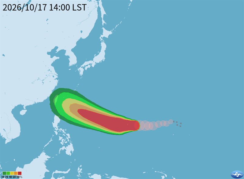
Taipei, Oct. 17 (CNA) Typhoon Champi could continue to strengthen and approach waters off eastern Taiwan next Thursday, with some forecast models suggesting it could move further west and cross the island, the Central Weather Administration (CWA) said Saturday.
As of 2 p.m. Saturday, Champi was 2,980 kilometers east-southeast of Eluanbi, Taiwan's southernmost tip, and moving west at 22 kilometers per hour (kph).
It had maximum sustained winds of 162 kph and a storm radius of 180 km, CWA data showed.
CWA forecaster Chang Cheng-chuan (張承傳) said Champi could intensify further as it moves west before turning west-northwest toward waters east of Taiwan.
The storm is expected to reach waters off eastern Taiwan on Thursday, after which it may gradually turn north, he said.
However, some forecast models suggest that if the Pacific high-pressure system remains strong, Champi could take a more westward track and possibly cross Taiwan, he said.
Taiwan will see fair to cloudy skies through next Tuesday, followed by rain from Wednesday, particularly in the north and northeast, Chang said.
- Society
Typhoon Champi could approach or cross Taiwan next week: CWA
10/17/2026 06:15 PM - Business
CPC freezes fuel prices for fifth straight week
10/17/2026 05:46 PM - Society
TRC reminds riders of etiquette after two reported incidents
10/17/2026 04:49 PM - Politics
Taiwanese visits to China rise nearly 20% despite travel warning: Agency
10/17/2026 04:19 PM - Society
More than 3 million people take Taiwan's public flu vaccinations in 2 weeks
10/17/2026 04:04 PM