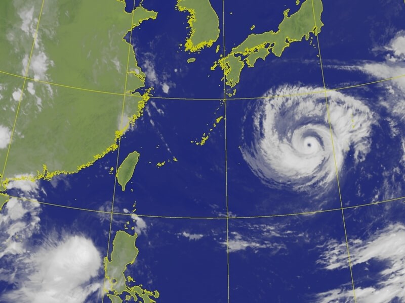
Taipei, Aug. 5 (CNA) A sea warning for Typhoon Dolphin could be issued as early as Friday afternoon as the storm moves closer to Taiwan, the Central Weather Administration (CWA) said Wednesday.
As of 8 a.m. Wednesday, the center of the typhoon was located about 1,680 kilometers east of Taipei and moving west at 20 kph, the CWA said.
Meanwhile, Tropical Storm Kujia formed west of Luzon at 2 a.m. Wednesday and is forecast to move east of the island before weakening and being absorbed by Typhoon Dolphin, according to the agency.
Steered by the Pacific high-pressure system, Dolphin is forecast to pass near the Ryukyu Islands on Friday and Saturday before gradually weakening and turning northward.
The typhoon is expected to make its closest approach to Taiwan between Saturday and Monday, when its outer rainbands are likely to affect the island, said the CWA.
In the event a sea warning is issued Friday, a land warning may follow if the storm's circulation moves close enough to affect outlying Matsu Islands or Taiwan's northern coast, the agency added.
Moisture associated with the storm will begin increasing on Thursday, bringing intermittent showers to northern Taiwan and Yilan, while southern and central Taiwan can expect brief afternoon thunderstorms.
As Dolphin approaches, foehn winds may affect Yilan on Thursday and Friday. Similar conditions could occur in Hualien, Taitung and Kinmen over the weekend.
Northern Taiwan is expected to see brief showers Friday, while central and southern Taiwan could experience scattered rain.
The heaviest rainfall is forecast for Saturday and Sunday, with torrential rain possible in mountainous areas of northern Taiwan and heavy rain forecast across northern and central Taiwan and Matsu.
Southern Taiwan and Yilan are forecast to experience intermittent showers.
The CWA also warned of long-period waves along the Keelung coast and eastern Taiwan from Wednesday, with the affected area potentially expanding to the central and northern coasts and waters around Penghu as the typhoon approaches.
Waves exceeding 5 meters are possible in waters near the typhoon's path, the agency said.
- Politics
Shen holds 1st Taipei campaign motorcade; Chiang urges debate coordination
10/11/2026 08:39 PM - Society
Firefighters work to extinguish Miaoli trash dump fire
10/11/2026 07:58 PM - Politics
Lai's National Day speech steady, avoided provoking Beijing: Scholar
10/11/2026 06:53 PM - Society
Songshan: The ups and downs of Taipei's 'other airport'
10/11/2026 06:36 PM - Society
Philippines opens largest OFW service center in Taipei, eyes expansion
10/11/2026 06:11 PM