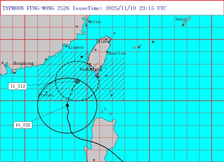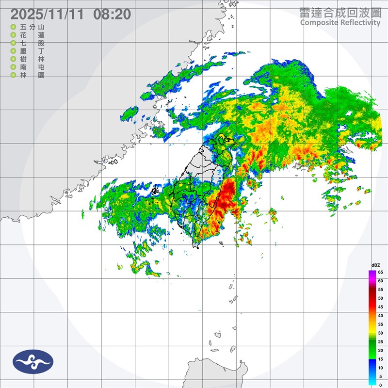
Taipei, Nov. 11 (CNA) The Central Weather Administration (CWA) on Tuesday issued a land warning for Typhoon Fung-Wong as the storm continues on its path toward southern Taiwan.
The agency issued a land warning for Typhoon Fung-Wong at 5:30 a.m., meaning that areas in Taiwan are expected to be within the storm's outer rim within 18 hours.
The initial warning area covers southern Taiwan's Kaohsiung, Pingtung, and the Hengchun Peninsula, and will be expanded to include Tainan in the south and Taitung in the southeast as the storm approaches, according to CWA forecaster Chu Mei-lin (朱美霖).
As of 7 a.m., the typhoon was located 360 kilometers southwest of Cape Eluanbi, Taiwan's southernmost point, and moving north northeast at a speed of 11 kilometers per hour.
It was carrying maximum sustained winds near its center of up to 119 kph and gusts of 155 kph.

According to the CWA, a land warning is issued 18 hours before a typhoon's radius of sustained winds of 34 knots (63 kph) is expected to hit the island of Taiwan or the outlying Penghu, Kinmen or Matsu islands.
Chu said the typhoon is expected to come closest to Taiwan between Wednesday afternoon and evening, before moving out to sea east of Taiwan early Thursday morning.
However, there remains uncertainty regarding its path and landfall location, with the potential impact area covering Taiwan's western regions and the Hengchun Peninsula, she said.
Chu said that as the typhoon approaches, its outer circulation could interact with the northeasterly monsoon, creating a combined effect and bringing significant rainfall to northern and eastern Taiwan.
-
Politics
Hsu Hsi-hsiang appointed acting prosecutor-general
05/07/2026 09:43 PM -
Politics
Two Taiwanese civil servants interviewed at hotel by Chinese police
05/07/2026 09:12 PM -
Politics
Peña pitches Taiwanese investment in Paraguay as gateway to Latin America
05/07/2026 09:07 PM -
Society
Ex-TV host's suspended sentence upheld in final ruling
05/07/2026 08:41 PM -
Politics
PTS deadlock deepens as Chair Hu booted from committee session
05/07/2026 08:32 PM