Taipei, Oct. 18 (CNA) The risk of flooding in Taiwan's Taroko National Park eased early Saturday as water from the Liwu River barrier lake began flowing back into its original channel, local authorities said.
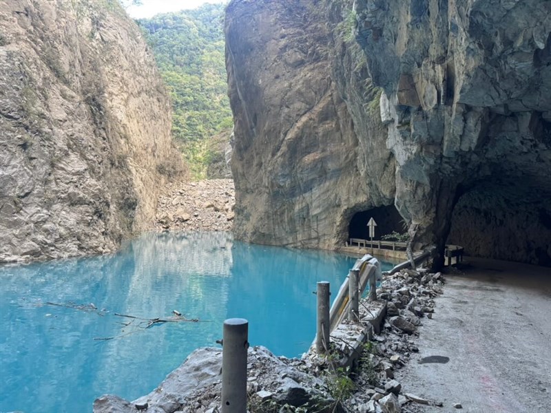
The lake had filled up to its capacity of 2.7 million tons of water due to recent heavy rain, and an overflow could hit downstream villages, roads, and bridges.
Oct. 17: Taroko National Park closes due to barrier lake overflow alert
Engineers plan to use excavators during the day to carefully breach parts of the landslide dam and direct the remaining water downstream, according to the Directorate General of Highways (DGH) and the Forestry and Nature Conservation Agency's (FANCA) Hualien Office.
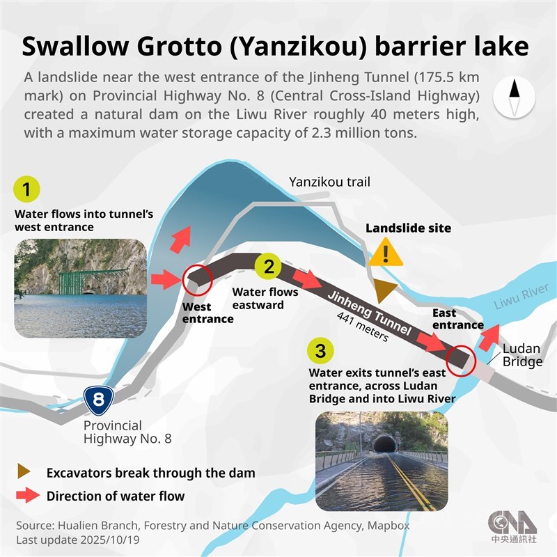
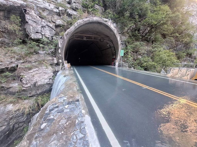
Images from the DGH showed that around 2:30 a.m., water from the barrier lake had overflowed onto the west entrance of Jin Heng Tunnel on Provincial Highway No. 8, flowed through the tunnel, and eventually rejoined the Liwu River, significantly reducing the threat to downstream areas.
By 6 a.m., the flow had stabilized, with water visibly draining along both sides of the road back into the riverbed, the FANCA Hualien Office said.
To ensure long-term safety, three excavators will be deployed along the old Highway No. 8 (now part of the Swallow Grotto Trail) to excavate near the upper edge of the dam and create a controlled drainage channel, said Huang Chun-tse (黃群策), head of the FANCA's Hualien Office.
A disaster prevention team from National Cheng Kung University specializing in landslide dams arrived on-site Saturday morning to conduct detailed measurements and data collection.
The team will reassess the dam's structure and potential impact zones to provide real-time safety assessments for the park and nearby settlements, the office said.
However, as a red alert remains in effect, Taroko National Park will stay closed on Saturday until authorities confirm that conditions are fully secure, the park administration said.
A barrier lake forms when debris from an earthquake, heavy rainfall, or a landslide blocks a river and creates a natural dam.
Such natural dams are often loosely structured, making them prone to erosion and collapse, especially as water accumulates, potentially causing catastrophic damage downstream, as was the case in the recent deadly flooding that occurred in eastern Taiwan's Guangfu town, also in Hualien County.
-
Culture
Thai Festival to open in Taipei next week with AI costume exhibit
04/15/2026 09:21 PM -
Politics
Interoperability crucial for Taiwan evacuation: Ex-Philippine Army official
04/15/2026 08:25 PM -
Business
Int'l flights to, from Taiwan to drop in May as fuel costs surge
04/15/2026 07:01 PM -
Society
'Orchestrated' Taichung cat killings done by human-trained dogs: Councilor
04/15/2026 06:43 PM -
Politics
TPP's Hsu Chung-hsin to replace Li Chen-hsiu in Legislature: CEC
04/15/2026 05:58 PM